|
|
|
|
|
|
|
|
|
||
|
Maps |
|
|
|
|
|
|
|
|
|
||
|
Maps |

|
On this page: Map Pack | Links Flag and National Anthem |
|
|
|
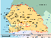
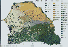
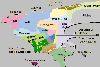
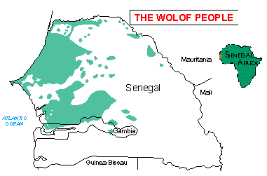
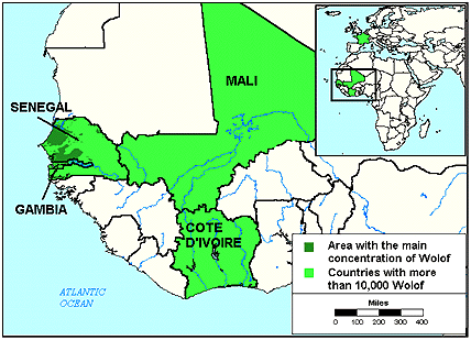
Above: The area in green shows the approximate areas in which the Wolof live in Senegal. Below: All the images below have been gathered from various resources on the internet. Clicking any map below will take you to a full size version. |
|
|
|
|
|
|
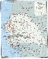
Senegal 282 k |
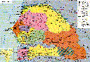
Senegal 130 k |
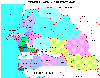
Administrative Departments 18k |
Senegal 46 k |
|
|
|
|
|
|
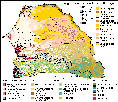
Land Use 90 k |
Vegetation 33 k |
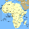
West Afr. 98 k |
Africa 14 k |
|
|
|
|
|
|
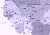
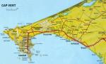
Cap Vert 106 k |
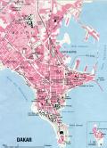
Dakar 149 k |
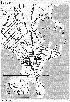
Dakar 124 k |
Dakar Suburbs 15 k |
|
|
|
|
 |
|
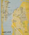
St Louis 52 k |
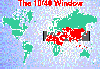
10/40 Window 21 k |
Senegal River Valley (Satellite) 35 k |
Information on the Flag and National Anthem of Senegal |
The site IZF.net has links to a variety of maps of Senegal.
Various general maps of Senegal provided by tourist sites include: Senegal (IZF), Senegal (Lonely Planet).
auSenegal also have a large collection of digital maps including Maps of Major cities (Dakar, Kaolack, St Louis, Thies, Ziguinchor, Touba) and Detailed Regional and Administrative Maps.
The University of Florida Map & Imagery Library includes digital maps of the Ocean around Dakar, Port of Dakar and Cap Vert Peninsula.
The Missions Atlas Project for Senegal includes Maps on Church status (Regions, Status of Evangelism, Bible Translation, Jesus Film Translation, Population density) and detailed regional maps around Strategic Towns (Dakar, Kaolack, Rufisque, Tambacounda, Ziguinchor, Diourbel, Louga, St Louis, Thies). You can also download PDF and KML versions of each map. Check out their interactive beta map for Senegal.
The Africa Data Dissemination Service disseminates maps showing vegetation and rainfall patterns over a given period. This service has been temporarily suspended due to degradation of the satellite sensor, but will recommenced once a new sensor is callibrated.
Satellites and NDVI data can be used to follow vegetation changes over time. Here is a case study of the use of this technology in Senegal.
USAID have a site for Long-Term Monitoring of Natural Resources in Senegal. It includes maps sattelite images, aerial photographs and aerial videos.
NASA visible earth images and animations for Senegal
Sahel MapJourney have a variety of geophysical and environmental maps for West Africa covering the years 1982 to 2004.
Environmental change in the Senegal River Valley.
World Statesmen includes links to a variety of historical maps of Senegal as well as a list of all the governors of Senegal throughout the colonial period.